If you attended our recent Pedestrian and Bike Safety Information Session, you know there was a lot of talk about how many crashes happen in and around our little village and how traffic speed impacts the likelihood and severity of crashes.
There were two rollover crashes in the heart of the village in one week the beginning of this month — one on S. Main near Stonegate around 7:45AM and one in front of the fire house on Monroe Ave around 2PM. Both were during clear, dry conditions. A 13 year-old girl was injured in a hit and run on Main St in broad daylight on a Sunday afternoon last year (also during clear, dry conditions). Just outside the village, a 70 year-old man was killed at the crosswalk on S. Main and Sunset at night last year. And in April, a driver hit a cyclist near that same intersection on a clear Saturday afternoon.
The most dangerous places to be in our village are the heart of the village and the state-owned roads that usher vehicles through there quickly. These are the very same places that make our village the unique walkable place it is; precisely the places that people want to walk and bike to and the streets they want to be on to do it.
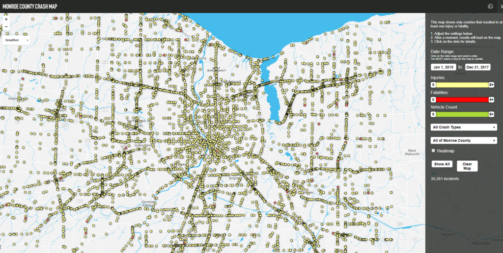
Reconnect Rochester just updated its Monroe County Crash Map with the most recent data (through 2017). And we can see that our arterial roads — State, Main, Monroe, Jefferson — are the ones that bear the brunt of the crashes. They are the roads that were sacrificed decades ago to become like highways to usher people through to newly built areas as the town grew.
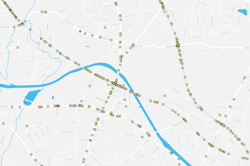
[Crashes 2010-2017, courtesy of Reconnect Rochester]
The problem is that an arterial road like Rt. 31 is very different in the heart of the village than it is near Pittsford Plaza or near Mitchell Road. In the village, people live in houses right along those roads; there are businesses right along those roads. They are houses, businesses and roads that were here before the car was in picture. That’s very different than neighborhoods situated on a street that connects with Rt. 31. When you drive on Rt. 96/Jefferson Rd or Rt. 64/Main St, you are driving through someone’s neighborhood, right in front of their yards and homes. You are driving through the heart of the town.
The current design and speed of these roads through the heart of our town place vehicle traffic and drivers at the top of pyramid. And that places the most vulnerable people on our streets — those outside of a car — at the bottom. And they are precisely the ones with the most to lose. If an inattentive driver flings her car up on the sidewalk and smashes through all the tables of people out enjoying their yogurt on Main St, the driver will walk away. She’s surrounded by a huge heavy metal box with airbags, seat belts and automatic brakes. The 10 year-old sitting at the table with his grandma will not.
Slowing the cars and making it safer for pedestrians and cyclists isn’t anti-car. Most of us who live around here are also drivers. It’s about putting the car in its place in our walkable village and the surrounding connected areas. It’s about livability. We already have places where drivers can drive their cars at high speeds where pedestrians and cyclists are not allowed. They are called highways. And we have plenty of roads where pedestrians and cyclists are technically allowed, but do so at their own peril (I’m talking to you, E. Henrietta and W. Jefferson Roads).
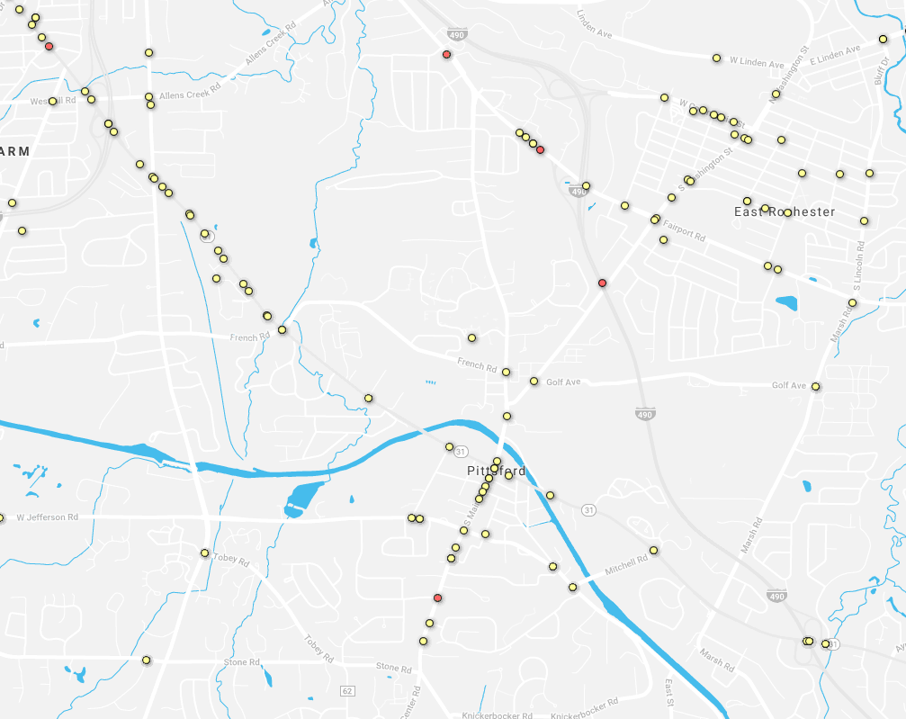
[Crashes Involving Pedestrian or Bike, 2010-2017, Courtesy of Reconnect Rochester]
Want to see the crash data for your specific neighborhood?
See Reconnect Rochester’s Crash Map, which contains reported crash data for Monroe County for 2010-2017.
Have opinions about pedestrian and bike safety in our walkable village?
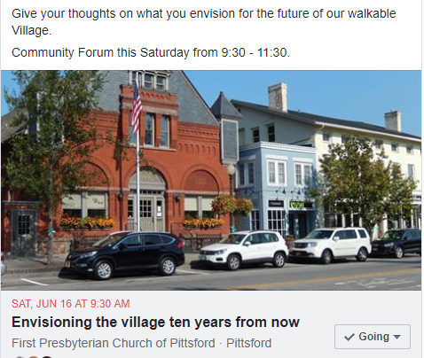
Attend the Village of Pittsford Community Forum on June 16th at the First Presbyterian Church, 9:30-11:30AM.

